As drone technology continues to advance, so does the field of aerial videography. One of the most exciting developments in this field is dynamic tracking drone videography, which allows filmmakers to capture moving subjects from the sky in a way that was previously impossible.
What is Dynamic Tracking Drone Videography?
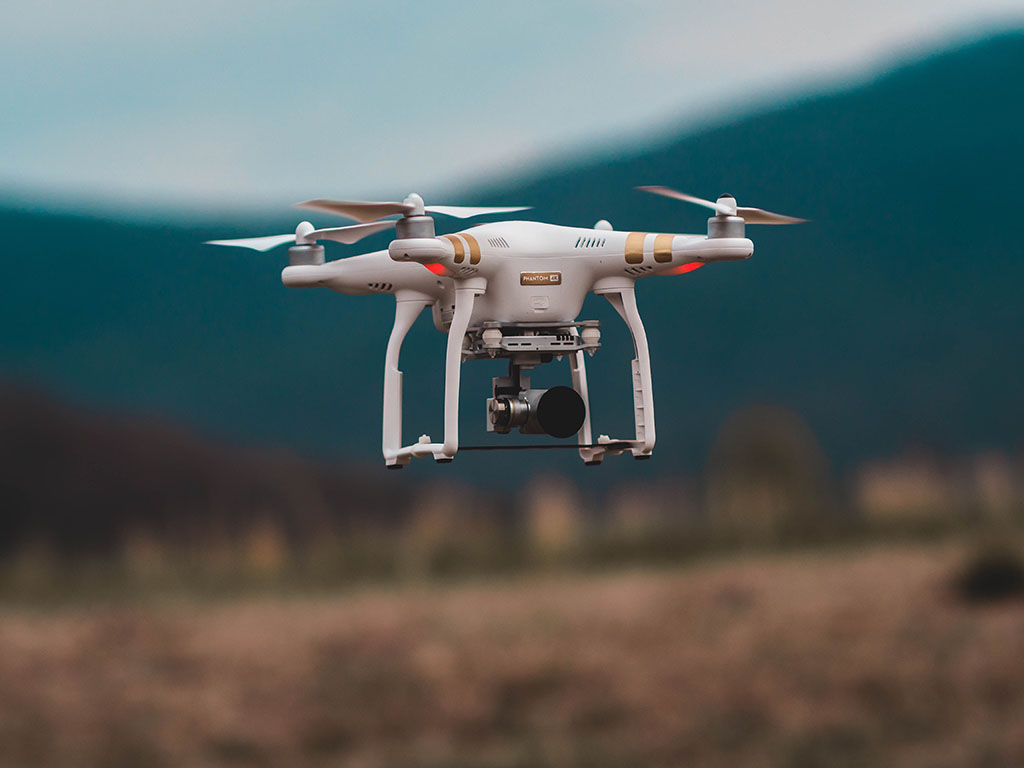
Dynamic Tracking Drone Videography is the use of drones equipped with advanced technology, such as GPS and object recognition software, to follow and track moving objects with a high degree of accuracy. With the right equipment and techniques, dynamic tracking drone videography is a powerful and versatile tool for professionals who want to capture high-quality footage of moving subjects from a unique perspective. This type of videography allows filmmakers and videographers to capture moving subjects from the sky in previously impossible ways, creating stunning, high-quality footage that can be used in a wide range of applications.
Benefits of Dynamic Tracking Drone Videography
Dynamic tracking drone videography offers several benefits, making it a popular choice for filmmakers and videographers. One of the key advantages is the ability to capture unique and compelling footage from a new perspective. Drones can fly at different heights and angles, allowing for stunning aerial shots that would be difficult or impossible to achieve with traditional filming methods. It also offers greater flexibility and mobility, as the drone can easily follow and capture moving subjects.
Another benefit of dynamic tracking drone videography is the high degree of accuracy and precision. The technology used in modern drones, such as GPS and object recognition software, allows the drone to identify and lock onto a moving subject and follow it in real-time. This results in smooth and seamless footage, free from the shakiness and jerkiness associated with handheld cameras.
It is also a more cost-effective and efficient option compared to traditional aerial videography methods. Using helicopters or cranes for aerial shots can be expensive and time-consuming, while drones can be operated by a single person and produce high-quality footage quickly and easily.
Future of Dynamic Tracking Drone Videography
As technology continues to evolve, the future of dynamic tracking drone videography is bright. Advances in drone technology and camera stabilization will enable even greater precision and control, making capturing even more dynamic and engaging footage possible. Additionally, using artificial intelligence (AI) and machine learning will allow drones to make more intelligent decisions and follow subjects more accurately while offering new features such as obstacle avoidance and automated editing. The increasing popularity of virtual reality and immersive video experiences will also drive demand for dynamic tracking drone videography as viewers seek more engaging and interactive content. Overall, dynamic tracking drone videography is set to continue benefiting a wide range of industries and applications, including filmmaking, sports, real estate, and emergency response.
Conclusion
As technology continues to advance and new opportunities emerge, the sky is truly the limit for dynamic tracking drone videography. Filmmakers and videographers can now capture moving subjects from the sky in previously impossible ways, thanks to dynamic tracking drone videography. It enables filmmakers and videographers to create stunning, high-quality footage that they can use in various applications such as film and television production, sports and action videography, real estate and property inspection, and environmental monitoring and research.
Drones using thermal imaging sensors can cover huge regions considerably faster than ground workers. Our experts specialize in FLIR thermal drone systems that can be deployed in minutes for SAR operations.
The most time-consuming and challenging part of a search and rescue/disaster response program is locating wounded and distressed people and organizing ground team responses for those people. At GD Drone Service, our drones are swiftly deployed at any location and offer mission-critical intelligence from their airborne vantage point. We locate and identify those in trouble and communicate to the ground team.
Whether it is a disastrous earthquake, missing hiker, or boater in stress, we have the aerial drone to promptly and efficiently search large areas while delivering high-quality video and thermal images.
Our drones quickly search large areas, identify a person in trouble using thermal signatures, check their status and surroundings using high-definition video, contact immediately to the ground team about the victim’s location, and offer critical information to the ground resource assets trying to reach victims. We provide immediate snapshots of wide areas, equipment, people, and drivers, including kayakers, bikers, truckers, and so forth. Learn more about our search and rescue/disaster response services by contacting us.